PLEAA GPS tracks come from many sources. PLEAA makes no warranty, either written or implied, for all tracks posted here. Download and use them freely at your own risk.
Some tracks are provided by others. If you download and find a problem with a track, please let us know so we can correct the problem or remove the track. This is a work-in-progress. We will continue adding tracks. If you would like to contribute a track or report a problem write us.
Tracks are broken down into the seven areas shown below on the Utah State Parks day ride main map.
Just click an area on the map to go to a listing of tracks in that area.
Tracks are stored here in .gpx format in ZIP files. If you are unfamiliar with .GPX files, [click here] or ZIP files, [click here]
Know before you go!
Caution! It is your responsibility as a rider to ensure roads/trails are open. Agencies like BLM and the Forest Service close roads and trails ALL the time. When you ride, ride responsibly. Preserve everyone’s access to our trails and wilderness! SITLA’s land ownership maps here: [Statewide Surface Land Status and Trust Lands Mineral Maps Download]
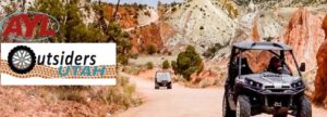 AYL’s Outsiders Utah is another great resource for OHV riders where you
 North West

Devil’s Playground/Grouse Creek areas:
Rocky Pass
Ingham Canyon
Mud Basin
Immigrant Pass
Rocky Pass Peak
Ingham Peak
Red Butte Creek
Keg Springs

North East
West Central
East Central
Arapeen tr 7 loop
Arapeen 3_1_73_71_72_3_Patton Loop track
Arapeen 35_2_1_94_9_1_2_35 Loop track
Buckhorn Ridge
Buckmaster System
Bullion Canyon Loop
Cane Wash
Carbon Co Trail
Cedar Mountain
Cottonwood Canyon
Devil’s Racetrack
Gooseberry South
Gooseberry System
Manning Res loop
Marysvale – Koosharem Loop
Mayfield-Clear Creek
Mayfield-Reeder Canyon
Swell Eagle Canover Devils Racetrack
South West
South Central
South East
Major Systems
Other Systems
(Several trails in one area)